The Cachapoal geothermal project surface study aimed to evaluate the geothermal potential within the Cachapoal concession in Chile’s O’Higgins Region, supported by the Geothermal Development Facility for Latin America (GDF). Before the onset of this two year exploration and evaluation period, the concession was regarded as a high-enthalpy volcanic prospect with a fault-controlled outflow zone identified through previous magnetotelluric (MT) and geochemical surveys in the 2010's.
However, subsurface understanding was limited—structural control and reservoir distribution were uncertain, and no unified 3D conceptual model existed to integrate available data.
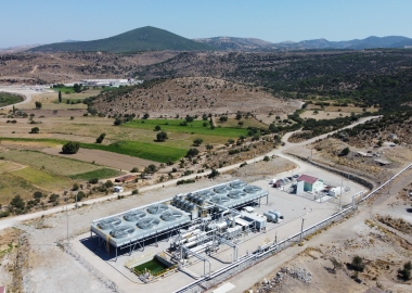
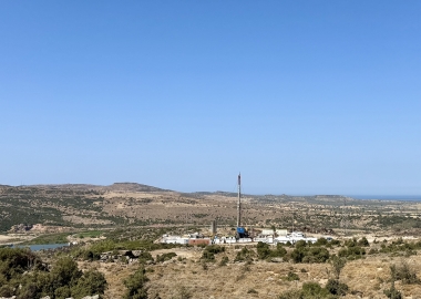
To address these knowledge gaps, the GDF program funded a comprehensive surface exploration campaign designed to reduce geological and exploration risk. The activities included field-based geological, structural, and alteration mapping; the collection and laboratory analysis of water samples integrated with existing geochemical data; and acquisition of 35 MT and 19 TDEM. Additional datasets included satellite-derived gravity maps and detailed coring logs from eight slim wells (DM-01 to DM-08) reaching depths of 373–1001 meters. These diverse datasets were combined into a coherent 3D geological model using Leapfrog Geothermal, with ongoing conceptual model validation and feedback provided by external expert consultant.
The integrated study led to a major revision of earlier assumptions about the geothermal system. Contrary to the initial interpretation of a conventional high-enthalpy volcanic system, no continuous conductive clay cap—typically indicative of such systems—was detected. Instead, the results delineated three distinct, fault-controlled geothermal prospects: Las Galerías, Don Rolando, and La Mama, each associated with surface geothermal manifestations such as hot springs. These systems appear to be driven by structural permeability along intersecting faults, and in some cases, by permeable unconformity layers that could enhance fluid circulation.
Geothermometric analyses indicate that these are more likely moderate-enthalpy systems, with the Las Galerías area showing the highest potential. While moderate, these combined resources may justify phased development depending on temperature gradient- and potential reservoir confirmation drilling outcomes.
The study also identified several key risks. The most significant is uncertainty regarding production-grade permeability, due to complex fault geometries and limited evidence of permeable formations. Additionally, development scalability could be constrained by the localized nature of fault-controlled reservoirs, although unconformity-related targets may help mitigate this limitation. Despite these uncertainties, the integrated geoscientific dataset and resulting conceptual model provide a robust foundation for future exploration.
In summary, the GDF-supported program has successfully transformed an underdefined geothermal concession into a well-characterized, prospective geothermal field. The comprehensive integration of geological, geochemical, and geophysical data significantly reduced exploration uncertainty and established clear targets for the next stage—reservoir confirmation drilling at Las Galerías, focusing on intersecting fault zones and unconformities near the interpreted upflow area.
Co-financed by the Federal Republic of Germany through KfW and with funding by the European Union, the study has laid a solid groundwork for future development, offering a realistic understanding of the resource’s potential and associated risks.